

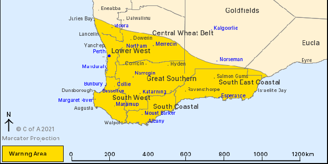
A severe weather warning now includes Mandurah, Perth and the South West.
A strong cold front will move from Jurien Bay down to Bremer Bay on Monday afternoon and into the evening bringing with it showers, thunderstorms and damaging winds of up to 100km/h.
"This is typical weather for this time of the year but winds may cause damage to property and make road conditions hazardous," a BOM spokesperson said.
Another cold front passed across the South West and Great Southern regions early on Monday morning but has now eased.
Cape Leeuwin recorded a wind gust of 94km/h at 10:35pm, while Rottnest Island recorded a wind gust of 94km/h at 1:24am.
If your home or property has significant damage, like a badly damaged roof or flooding, call the SES on 132 500.
 Pop-up ice skating rink glides back into Mandurah for winter school holidays
 Federal opposition leader Angus Taylor sits down with local business owners in Mandurah
 Police search for missing man last seen leaving Rockingham Hospital
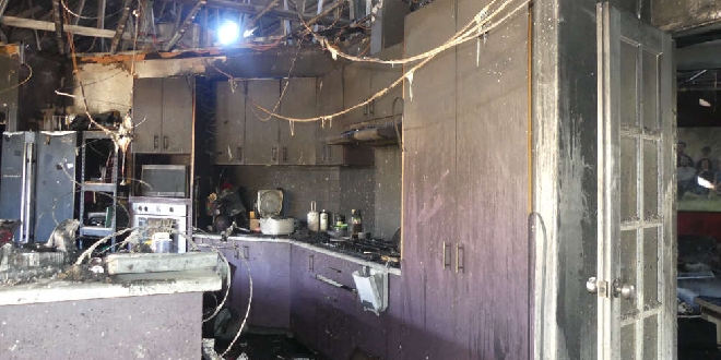 West Aussies urged to be on high alert after surge in winter house fires
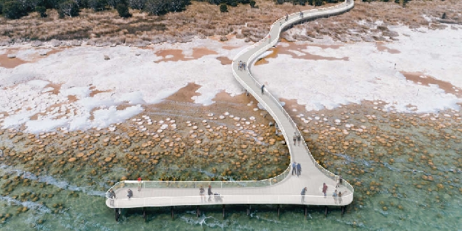 New $3.4 million boardwalk to be constructed at Lake Clifton thrombolites
 City of Mandurah rolls out new tactile bin lids, accessibility stickers to support residents with low vision
 Driver dies in hospital after Australind crash
 Welfare concerns for woman with dementia last seen in Cooloongup
 Charges laid over fatal West Coolup crash